The 7 Best Off-Roading Trails in the Carbon Corridor
Take in the amazing scenery at locations only accessible with four-wheel drive.

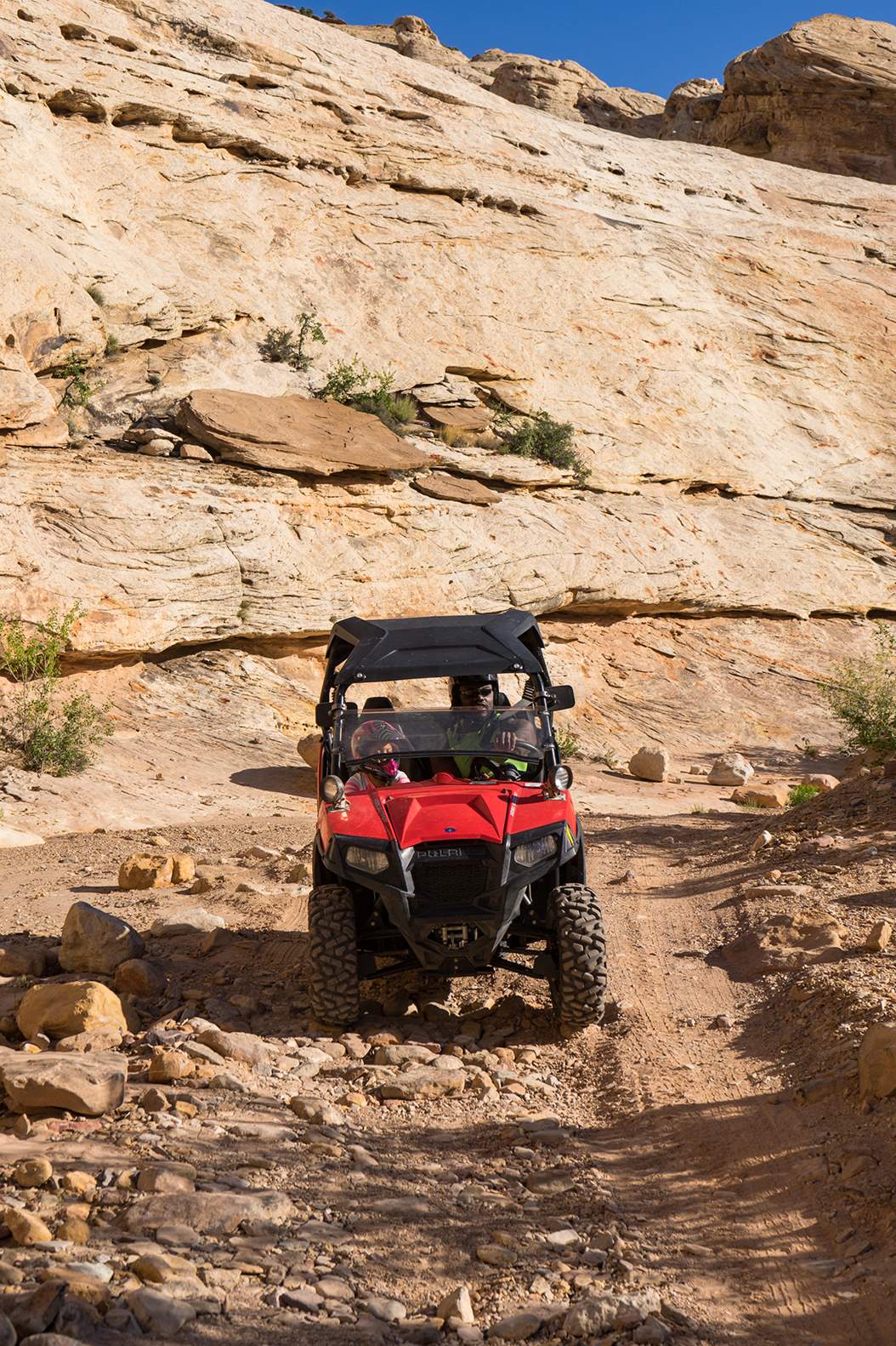
Looking to go off-roading in Utah? You’re not alone. Riding off-highway vehicles (OHVs) has become one of the fastest-growing sports in the state. It attracts both families and adventurers looking to explore off-the-beaten-path destinations that are only accessible with four-wheel-drive.
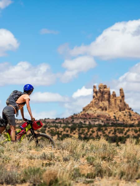
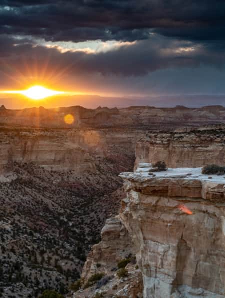
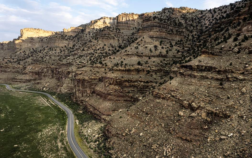
Located about two hours southeast of Salt Lake City, the Carbon Corridor has a huge variety of terrain to explore — including mountains, canyons, deserts and forests. The area, previously known as Castle Country (as is reflected on some regional maps), includes parts of Carbon and Emery counties, and it features the incredible sights of the San Rafael Swell, the Manti-La Sal National Forest and Nine Mile Canyon, among many others.
While the area has become more and more popular with off-roaders, it remains sparsely populated and largely under-the-radar among visiting tourists. Both Price and Helper, towns in Carbon County, make great basecamps for riders. Each has all the amenities you need for a memorable trip, including restaurants — like The Tangerine Eatery in Price or Balance Rock Eatery in Helper (Read: Turning Carbon Into Culture). You can also find hotels and off-road rentals and guide services in and around both areas.
You could spend weeks covering the extensive trail network in the region, which is organized like a ski resort, with ratings for easiest, more difficult and most difficult trails. You can plan an outing using the maps of the region, but here are seven of the top rides that keep people coming back for more. Just remember to Tread Lightly and ride responsibly.1. Devil’s Racetrack
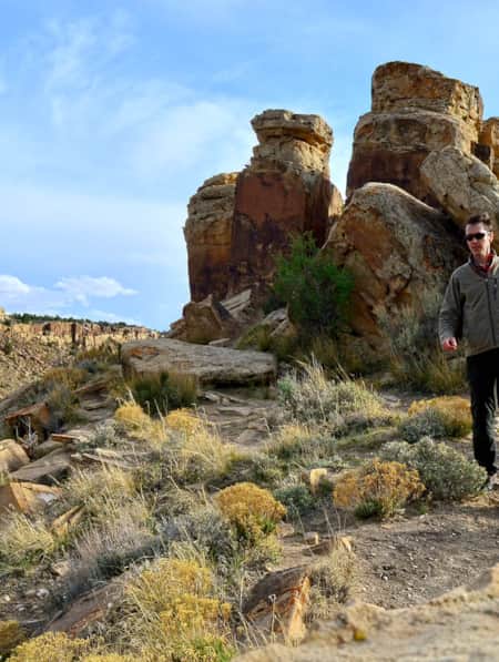
As you may have guessed from the name, Devil’s Racetrack is a challenging trail requiring some technical skill to navigate the rugged sandstone in the San Rafael Swell. The trail is filled with memorable sights along the way, starting with Dutchman Arch near the beginning of the ride. You’ll find a variety of terrain as you navigate the 17.6-mile round-trip. At times you can cruise along relatively flat straightaways, while other times require slow and careful climbing over significant rocks. The views of Devil’s Canyon are spectacular, but just about everywhere along the route has something to impress.
Getting there: From Green River, Utah, head west on I-70 to exit 131. Follow Temple Mountain Road about 9 miles to the trailhead.
2. South Skyline Drive
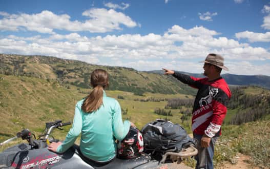
The South Skyline Drive is the backbone of the Arapeen Trail System, which features more than 300 miles of trails between Utah Highway 31 to the north and the Fishlake National Forest to the south. The trail runs through the scenic Manti-La Sal National Forest, and it’s a good option for beginners looking to start exploring with off-road vehicles. It stretches for 58 miles and is a relatively easy drive with a high-clearance, 4x4 vehicle. (Read: Riding the Arapeen OHV Trail of Central Utah)
If you want to make things more exciting, there are many spurs that will put your driving to the test. You’ll enjoy magnificent vistas as you drive over the western ridgeline of the Wasatch Plateau, and the trail has ample opportunity for camping, fishing and hunting. Make the drive in mid to late summer to enjoy the wildflowers on display.
Getting there: To reach the western start of the trail, take U.S. Highway 89 from Sanpete Valley. On the eastern side, you can reach trailheads from Castle Dale and Ferron, located along Highway 10.
3. Gordon Creek Falls Trail
Located just northwest of Price, this mild/moderate trail gives riders a chance to cool off with a quick dip in the creek. They’ll also get to enjoy the sight of two waterfalls, a train trestle, an abandoned cabin and plenty of wildlife amidst the rugged terrain. The 15-mile trail makes for a good afternoon outing and can be completed in a couple of hours, depending on how much time you spend splashing around. Note that this area is susceptible to flash floods, so keep an eye on the weather. Those looking for a longer ride can take advantage of the off-roading trail system west of Price, which makes it easy to create a 60-mile loop.
Getting there: Travel north on Highway 6 from Price toward Helper, or south from Salt Lake City. About four miles outside of town, turn left on Consumers Road. After 3.2 miles, turn left on Trestle Road. This dirt road will take you to the Gordon Creek Falls trailhead.
Arapeen Trail
Photo: Jim Urquhart
Arapeen Trail
Photo: Jim Urquhart
"Located about two hours southeast of Salt Lake City, the Carbon Corridor has a huge variety of terrain to explore — including mountains, canyons, deserts and forests."
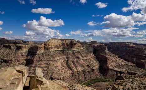
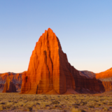
San Rafael Swell
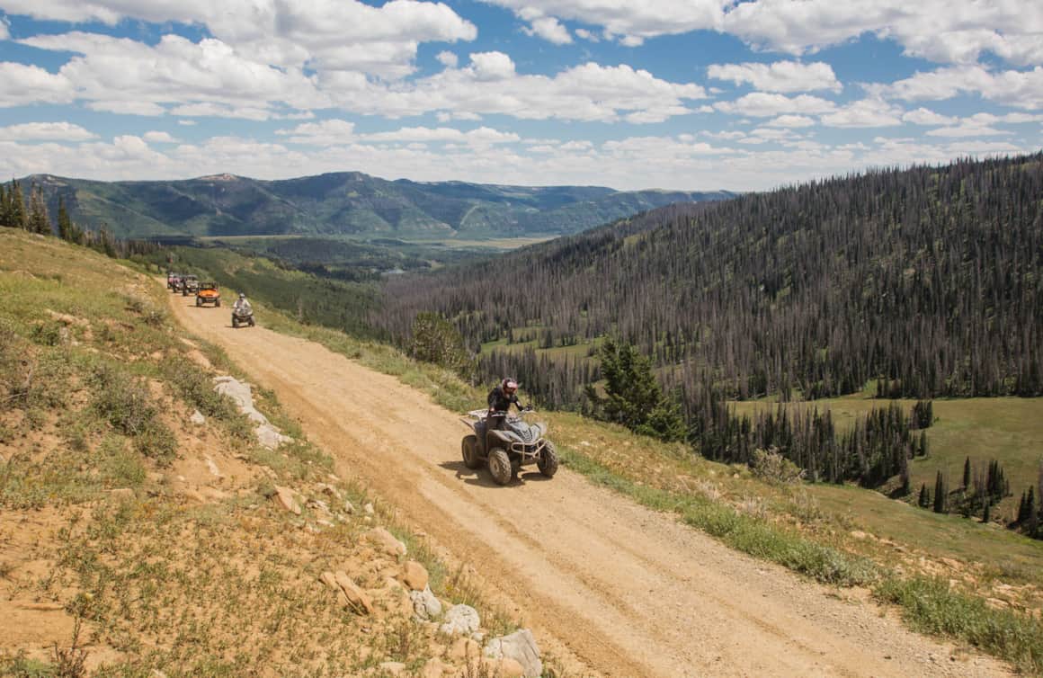
Arapeen Trail
Nine Mile Canyon
Photo: Ben Grimes
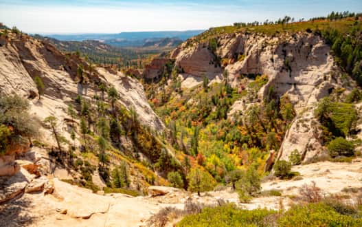
Manti-La Sal National Forest
Photo: Will Pattiz
San Rafael Reef
Photo: Utah State Parks
4. Eva Conover/Fixit Pass Loop
You can thank the construction of I-70 for this off-road trail. In order to build the interstate in the 1960s, a road was created to get the equipment necessary for building large highway bridges into the canyons. County Commissioner Eva Conover was instrumental in getting the access road built, so it’s named for her.
Today, the narrow trail is an excellent way for dirt bikes and side-by-sides to take an unforgettable tour of the San Rafael Swell. Along the route, you’ll see the Swasey Cabin, built in 1921 for cowboys who were running cattle in the area. You’ll also get to drive under those highway bridges that take I-70 travelers far above the canyon. Fixit Pass is a 4.9-mile route that connects to Eva Conover, and it’s a lot more rugged. It’s rated intermediate, but the pass itself is technically challenging.
Getting there: Reach Fixit Pass from Ferron, while the Eva Conover Trail is best reached by Exit 131 off I-70.
5. Nine Mile Canyon
One of the more accessible natural wonders in this area is Nine Mile Canyon, which features a large number of Fremont Indian dwellings, petroglyphs and pictographs (Read: A Rural Community Leading the Way in Stewardship and Preservation). So many, in fact, that the area is dubbed the “World’s Largest Art Gallery.” Nine Mile Canyon is much longer than its name would suggest, with the road through it (paved since 2014) stretching for 46 miles. The road makes it more accessible, but that doesn’t mean that off-roaders won’t find some fun places to play in the region. You can start on the paved road near Wellington and take it to Trail 0, a dirt road also known as the Backbone Trail. Head west and this trail will take you to Coal Creek and the town of Price (and beyond). There are lots of smaller trails to explore between Price and Nine Mile Canyon, making it a fun place to play after you see the petroglyphs (Read: How to Visit Rock Imagery Sites Like an Archaeologist). While many of these trails are mild or moderate, make sure to have a good map with you (good advice for any off-roading outing) as cell service isn’t usually available.
Getting there: From Wellington, take U.S. 191 east before turning left on Soldier Creek Road. That will turn into Nine Mile Canyon Road after about 3.5 miles.
6. Reeder Canyon Loop
Get some variety from the desert and rocky landscapes with this loop in the Manti-La Sal National Forest. Start your ride at Joe’s Valley Reservoir, where you’ll find both a campground and excellent fishing. You’ll start at 7,000 feet of elevation and make it all the way up to 10,500 feet, so you can expect lots of ups and downs along the route, but it’s all rated beginner/moderate, so you don’t have to deal with much that’s overly technical. Instead, take the time to enjoy riding among the pine trees and quaking aspens that line the route. The total distance is about 30 miles, and it makes for a good half-day ride.
Getting there: The trailhead is just outside of the Joes Valley Campground, which is on the western side of the reservoir just off of Highway 29.
7. Behind The Reef Trail
The “reef” in the name of this trail refers to the giant sandstone uplift that sits on the southeast edge of the San Rafael Swell. This difficult trail isn’t for that faint of heart, as at times it edges alongside 200-foot cliffs. The remote location also means limited to non-existent cell service and support.
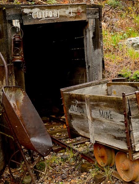
If you are craving an adventure, you’ll be rewarded with beautiful views of Temple Mountain and a thrilling ride. This area was also part of the uranium mining boom, so you’ll find lots of mining roads in addition to an airstrip and some abandoned buildings. A highlight includes the ride through the shallow stream (or streambed, depending on the time of the year) at the bottom of the canyon, with tall, rugged walls on either side. The total ride is about 57 miles, and it’s one you’ll never forget.
Getting there: The trailhead is on the west side of the San Rafael Reef. Take Highway 24 to Goblin Valley/Temple Mountain Road, and instead of turning into Goblin Valley, continue west through the reef. Continue on Behind the Reef Road about 6 miles to the trailhead parking area.
What's Nearby
-
Green River State Park
Green River State Park is a great place to begin your adventure on the Green River. If you make the journey you’ll be rewarded with easy access to the river, sheltered campgrounds and picnic areas, a nine-hole golf course, and a new eighteen-basket disc golf course.
-
Helper
Settled in 1881, Helper was named after the team of “helper” coal-powered steam engines that assisted freight trains up the neighboring canyon and over Soldier’s Summit; the city was created because of and for the coal industry. Though the tracks are still integral in the town’s DNA and even more-so, history, its identity has changed.
-
Price
Price sits close to the northern section of the San Rafael Swell, which is home to vast deserts, yawning canyons, and fascinating rock formations. The area is known for its coal mining, as well as its recreational opportunities.
-
San Rafael Swell
San Rafael hikes and bike rides offer unique terrain and jaw-dropping scenery. Learn about the area’s trails and start planning your trip!
-
Scofield Reservoir State Park
From boating in the summer to ice fishing in the winter, learn more about why Scofield State Park is an outdoor enthusiast’s paradise.
Discover More
-

A Grand Tour of the San Rafael Swell
This grand tour goes into the heart of Utah's Swell from north to south, connecting the uplift’s spectacular views with playful slot-canyon hikes, bike excursions, dinosaur bones, and soft-serve cones in town.
-
Bikepacking through Time in the San Rafael Swell
We're miles away from civilization here in southeastern Utah’s San Rafael Swell, and we carry everything we need on our bikes. This is the type of adventure I've longed for, a trip that reminds us of our self-worth, resilience, and how little we actually need to survive.
-
Marysvale: Miners Park and ATV
Close to the expansive Paiute ATV Trail, Miners’ Park, and the self-guided driving tour on the road that leads to it, shows the heyday of activity in Utah’s “Canyon of Gold.”
-
Max Reid and the Max Reid ATV Trail
Meet an Icon of Utah's Renowned ATV Trail System
-
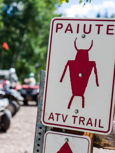
Paiute ATV Trail
If you love to ride ATVs, Utah’s Paiute Trail is perfect for you. Learn about the more than 1,000 miles of trails for every level of rider!
-
Riding the Arapeen OHV Trail of Central Utah
Looking for the best off-roading trails in Utah? You have to try the Arapeen OHV Trail, featuring hundreds of miles of scenic backcountry trails in Central Utah. Start planning now!
-
San Rafael Swell Throughout the Seasons: 4 Reasons to Visit
From narrow slot canyons to grand sweeping vistas, sandstone plateaus to meandering rivers, San Rafael Country and the San Rafael Swell are home to some of the most spectacular scenery in Utah.
-
The 46 Miles of Nine Mile Canyon
Follow Nine Mile Canyon Road into the rugged and remote Book Cliffs, where messages from the ancients interface with settlers of the West and modern ways of thinking.
-
The Underrated Trails Within the San Rafael Swell
Utah's San Rafael Swell features a vast landscape of winding gorges carved deep by rivers, and you'll find multi-colored sandstone mountains and mysterious slot canyons. Here's a quick guide to some of the best trails to explore the region.
-
The Undiscovered San Rafael Swell
Circle back to the San Rafael Swell, a gem of public lands in Central Utah you may have missed on your last visit through some of Southern Utah's Mighty 5® national parks. The Little Grand Canyon of the San Rafael Swell is a stunning panorama from above, and an incredible adventure within.
-
The Unparalleled Paiute ATV Trail
If you’re looking for great ATV vacations, look no further than the Paiute ATV Trail in central Utah. Read all about it and plan your off-road adventure today!