Accessibility in Utah’s Mighty 5 National Parks

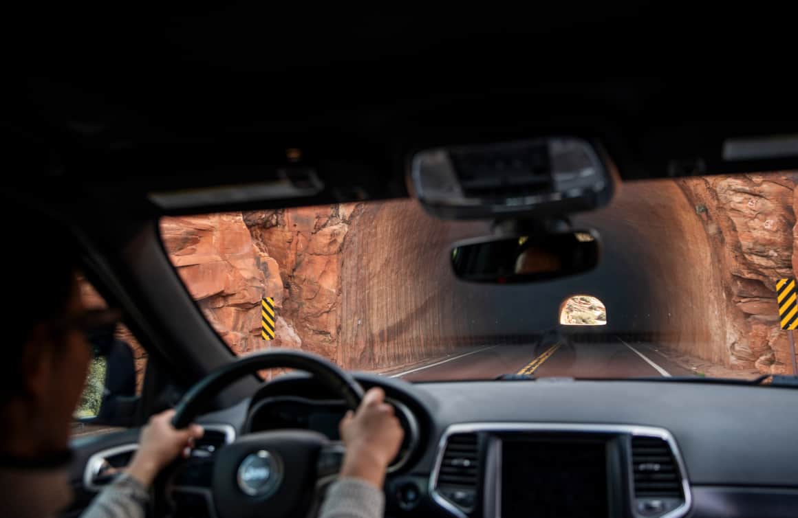
Utah's Mighty 5® national parks boast breathtaking landscapes and unparalleled natural beauty. And thanks to ongoing improvements throughout each of the parks, hiking trails, scenic roads and facilities are increasingly accessible for visitors of all ability levels.
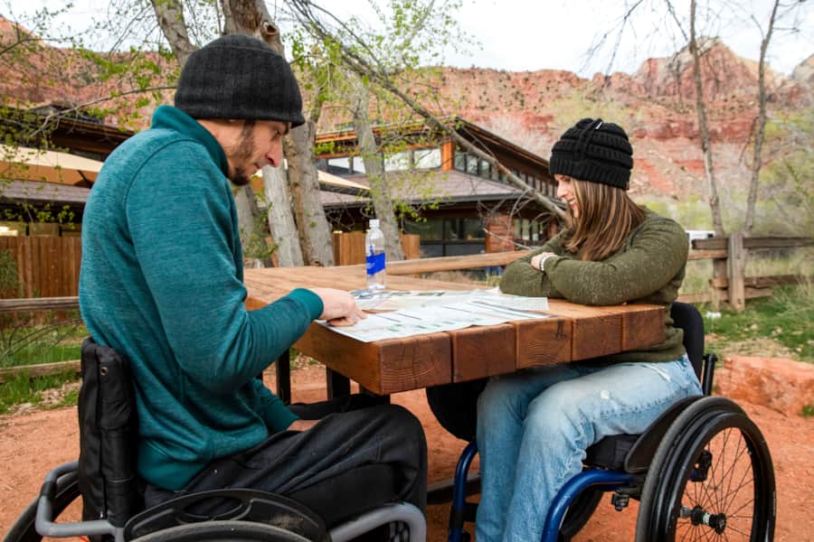
If you're planning a trip to one of Utah's national parks and someone in your group has limited mobility, you might be wondering about the best trails and activities to ensure a memorable visit. We’ve enlisted the help of Ashley Lyn Olson, founder of wheelchairtraveling.com, to put together a recommended round-up of accessible trails and amenities within each of Utah’s national parks.
Additionally, park visitors should note that U.S. citizens or permanent residents with permanent disabilities qualify for the Interagency Access Pass, which provides free or discounted access to 2,000+ federal recreation sites.Accessibility recommendations by national park:
"Utah's Mighty 5 national parks boast breathtaking landscapes and unparalleled natural beauty. And thanks to ongoing improvements throughout each of the parks, hiking trails, scenic roads and facilities are increasingly accessible for visitors of all ability levels."
– Ashley Lyn Olson
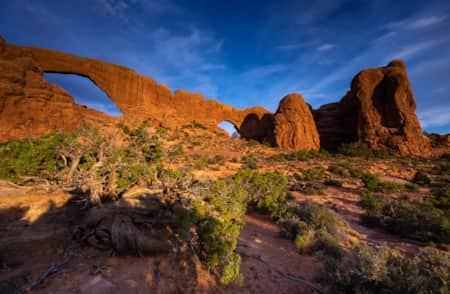
Arches National Park
Arches National Park is one of America's most beloved national parks, a 73,234-acre wonderland of over 2,000 red rock arches. Many of the rock formations can be seen from the road, but you’ll find numerous parking pullouts where you can get a closer look.
The Arches National Park Visitor Center is fully accessible, providing accessible parking, restrooms with grab bars and accessible stalls, a lowered information desk, tactile exhibits, and audiovisual materials with captions to ensure an inclusive experience for all visitors. Additionally, the Visitor Center features accessible drinking fountains and clearly marked paths leading to the main building and surrounding areas.


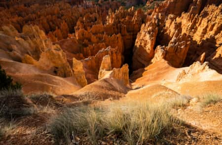
Bryce Canyon National Park
Bryce Canyon National Park’s geological rock formations captivate visitors with their delicately odd silhouettes towering into the sky. Some structures seem to defy gravity — a magnificent representation of how nature displays its balance. Occasionally, white limestone is painted across red rocks or dripped on top of them resembling snow-capped peaks. Fourteen overlooks are classified as accessible at Bryce Canyon, many with relatively level and paved short paths along the canyon’s rim.

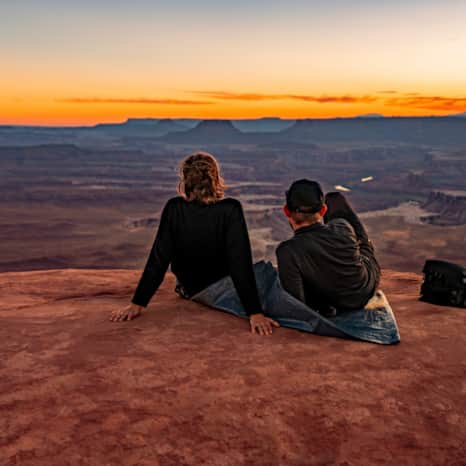
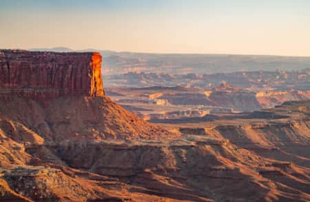
Canyonlands National Park
Endless deep canyons, towering mesas, pinnacles, cliffs and spires stretch across 527 square miles in Canyonlands National Park. With scenic roads along the rim and base of Canyonlands National Park, visitors don’t need to leave their vehicles to enjoy the park, but they can if desired.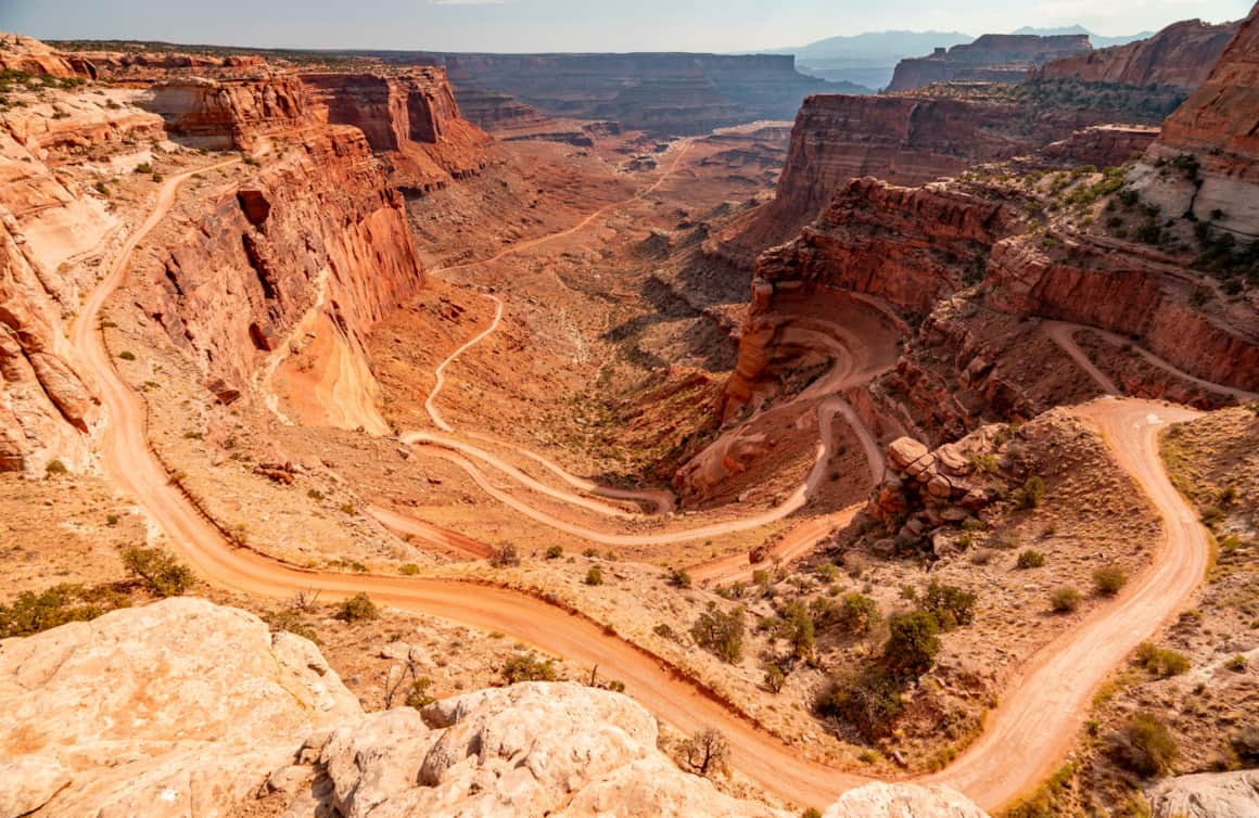
With scenic roads along the rim and base of Canyonlands National Park, visitors don’t need to leave their vehicles to enjoy the park.
Located near the Willow Flat Campground, the Green River Overlook is wheelchair accessible by a paved trail from the site's parking lot.
Canyonlands is divided into four districts: The Needles, The Maze, Island in the Sky, and the rivers. Island in the Sky is considered the most accessible.
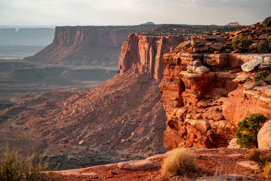
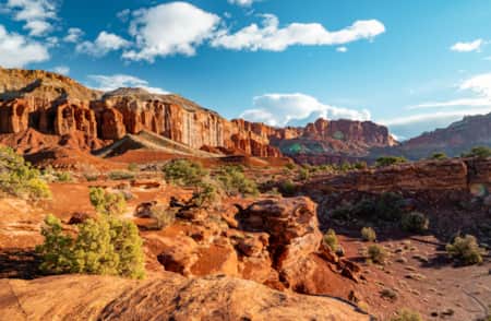
Capitol Reef National Park
Known for its red rock cliffs, canyons, domes and bridges, it's hard to rival the expansiveness of Capitol Reef National Park. While many of its easy hiking trails include fairly level, but uneven ground, you can actually see some of the best views from the paved Scenic Drive (7.9 miles, one-way).

Capitol Reef Scenic Drive
Before visiting, download or print out the Scenic Drive self-guided tour. From the Scenic Drive, you can access Grand Wash Road and Capitol Gorge Road, dirt spur roads that lead deep into the canyon, making you feel like you're on an adventure from another time. The spur roads are typically suitable for passenger cars and RVs up to 27 feet in length. The Scenic Drive is currently undergoing some accessibility improvements, including expanding the road and popular parking areas and adding accessible vault toilets at Capitol Gorge parking lot, located at the end of the drive. Improvements are expected to be complete in the fall of 2024. The Visitor Center offers accessible amenities, including accessible parking, restrooms with grab bars, tactile exhibits, an information desk with a lower counter and audiovisual materials with captions, making it a good starting point for your visit.

Ramble down the 8-mile Capitol Reef Scenic Drive for breathtaking views.
Photo: More Than Just Parks

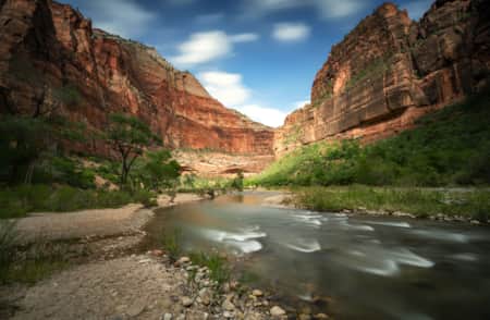
Zion National Park
Zion National Park is consistently Utah’s most visited national park. The mighty Virgin River continues to carve through the sedimentary rock like a master sculptor, transforming this desert pocket into a lush oasis. When planning a visit to Zion, it's important to review the park's current conditions for any closures that might impact accessibility (Read: How to Visit Zion).
Visitors should also plan an early arrival to the Visitor Center to board the accessible Zion Canyon park shuttle, which has space for two wheelchairs. Park shuttles generally arrive every 5-10 minutes on the Zion Canyon Line, and a round trip takes about an hour and a half. For a guided park tour, visitors can pre-register to participate in the “Ride with a Ranger” program, which uses a 40' bus with space for four wheelchairs. The Zion National Park Visitor Center is fully accessible, featuring accessible parking, restrooms with grab bars, a lowered information desk, tactile exhibits and audiovisual materials with captions to ensure an inclusive experience for all visitors.
While the shuttle provides a great accessible option for most visitors, guests with further medical concerns can also request a “Yellow Permit” pass to drive a personal vehicle up the Zion Canyon Scenic Drive, which is typically only accessed by shuttle. Even with an accessible placard, visitors must request this pass at the park entrance station, Visitor Center, or museum.
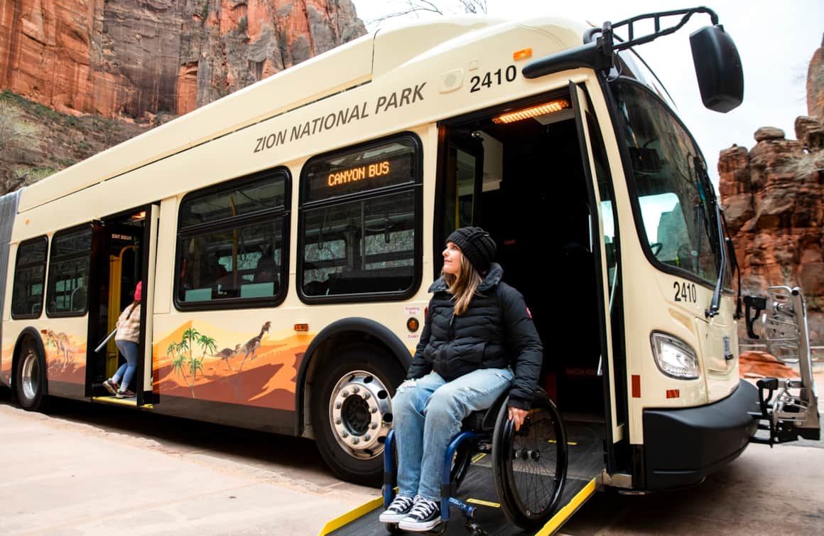
The Zion Shuttle operates within Zion National Park, beginning at the visitor center, just north of the Springdale park entrance. It typically comes every 10-15 minutes.
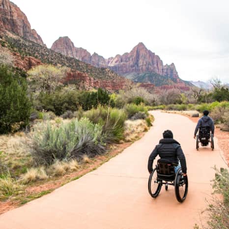
One of the most pleasant and accessible trails in the park is the Pa'rus Trail.
The Zion National Park Visitor Center is fully accessible, featuring accessible parking, restrooms with grab bars, a lowered information desk, tactile exhibits and audiovisual materials with captions to ensure an inclusive experience for all visitors.
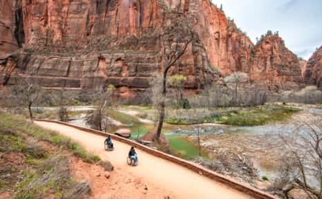
The Riverside Walk Trail may be partially or completely doable leading up to the edge of the Virgin River.
The National Scenic Byway (S.R. 9) between Zion's main canyon and Mount Carmel is an extra stunning way to cover a lot of amazing ground.

Utah's National Parks
-

Arches National Park
Arches National Park contains more than 2,000 natural arches—the greatest concentration in the country. Find places to stay, itineraries, reservation info and weather for Arches, Moab and Canyonlands National Park.
-
Bryce Canyon National Park
An alpine forest with as many red rock hoodoos as trees. At dawn and dusk, mule deer graze the forested plateau along the road into Bryce Canyon.
-
Canyonlands National Park
Canyonlands is home to many different types of travel experiences, from sublime solitude in the more remote stretches of the park to moderate hikes through the Needles district to the opportunity to create your own version of one of the West's most photographed landforms, Mesa Arch.
-
Capitol Reef National Park
Even considering Utah’s many impressive national parks and monuments, it is difficult to rival Capitol Reef National Park’s sense of expansiveness, of broad, sweeping vistas, of a tortured, twisted, seemingly endless landscape, or of limitless sky and desert rock.
-
Zion National Park
Whether you are trying to catch your breath while climbing the trail to Angel's Landing or watching the shadows constantly change the mood of the Court of the Patriarchs, Zion National Park is always ready to quench your appetite for outdoor wonder.
Read the Stories
-
A Sensory-friendly and Adaptive Survival Guide to Traveling in Urban Utah
Helpful suggestions for families of disabled and neurodiverse kiddos to help maximize enjoyment.
-
Adapt, Access, Success
“When people think of a ‘disability,’ a lot of the time, they think about what a person can’t do,” says Gail Barille, CEO of National Ability Center, “But at NAC, we think of it as a differing ability.” The emphasis being on what the person can do.
-
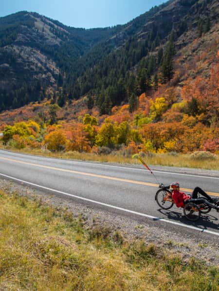
Adaptive Cycling in Colorful Cache Valley
Bob Wassom revisits his roots using adaptive cycling on an e-trike, through Cache Valley, Utah; a ride full of color, variety, scenery and history.
-
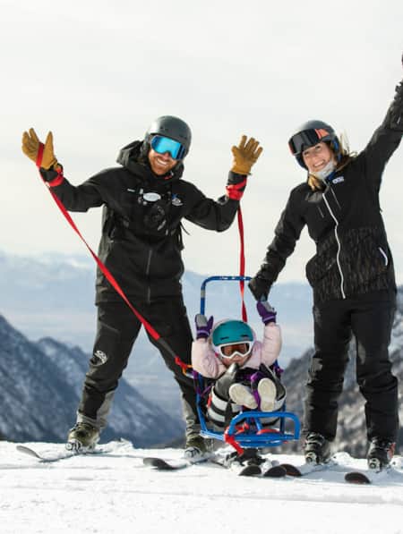
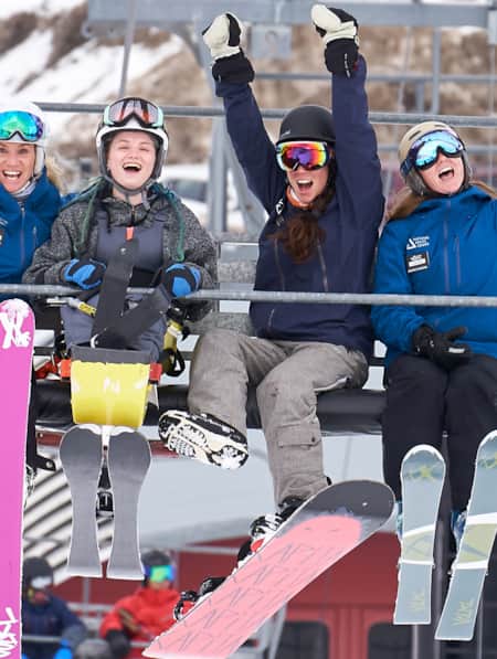
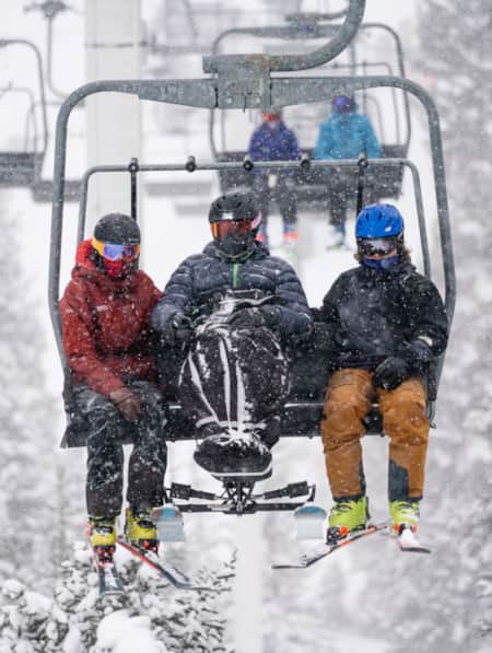
Adaptive Skiing: Meet Three Inspiring Young People
Meet three young skiers who have overcome physical challenges to find freedom on Utah’s mountains.
-
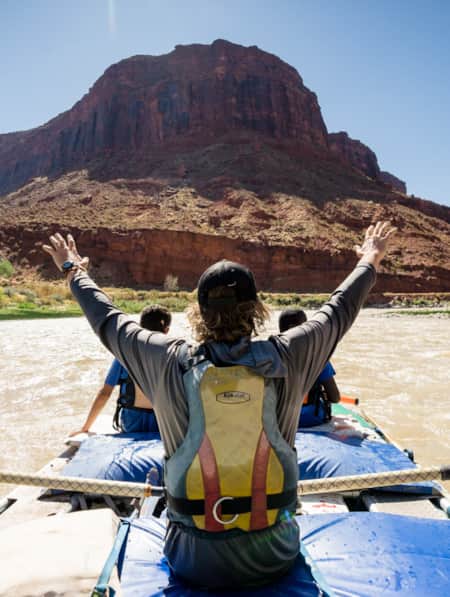
Fisher Towers River Rafting
Join Bob Wassom, and a few others, as they raft down the Fisher Towers stretch of water disproving any idea or stereotype suggesting disabilities hinder outdoor recreation.
-
Getting Back on the Mountain
Adaptive recreation puts everybody in the game, regardless of age or ability.
-
Spreading the Joy of Adaptive Recreation
Meet three National Ability Center staffers who live outdoor adventuring.
-
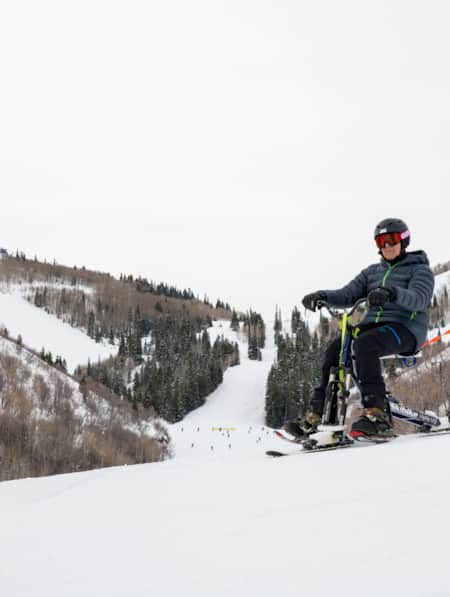
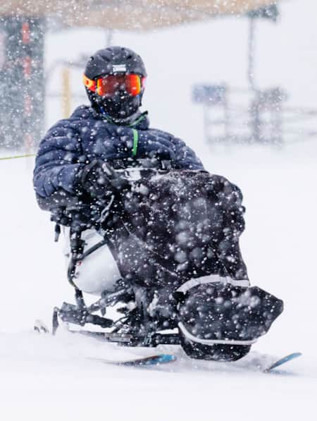
TetraSki Offers Freedom and Independence for Skiers of All Abilities
Utah program’s innovative adaptive recreation equipment makes an Alta powder day even more legendary.
-
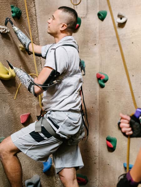
Together They Climb
Utah’s most unlikely adventure family shows America that you don’t have to fit into the outdoors stereotypes to find your place on the trail.
-
Utah's Outdoors Are Wide Open for All Abilities
Utah’s National Ability Center is known for changing lives through its adaptive recreation programs. Truth is, just setting foot on the center’s 26-acre ranch can feel transformative.
-
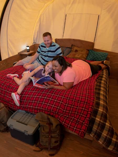
Utah’s Scenery Offers A Backdrop for Inclusive Family Camping
While Utah is known for its amazing outdoors, it also has resources that ensure that families and individuals of all abilities can access these places.
-
When Turns Are About Adaptability, Not Disability
What happens when a paralyzing accident makes skiing impossible? You start over, hope for the best — and look for all the help you can find. Here’s how one ski instructor got back on the hill with a lot of help from adaptive technology.