An Insider's Guide to Hiking in the Tushars
One of Utah’s best-kept hiking secrets, the Tushar Mountains deliver sun-dappled trails, wildflower-sprinkled meadows, shaggy mountain goats and forever views from rocky summits. Check out these six choice Tushar trails and make plans to discover Utah’s third-highest mountain range.

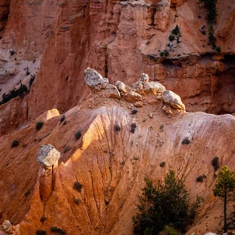
It’s easy to escape the frantic pace of everyday life by heading to southwestern Utah where unknown lands still beckon you to explore scenic treasures and discover the pleasures of solitude (Read: “Central Utah Byway: Beaver Canyon and the Sevier River Valley”). The Tushar Mountains, the state’s third-highest range, is such a place. Easily glimpsed from I-15 in Beaver County — also known as Ramblers — the snowcapped Tushars offer trails that scramble to dazzling mountaintop views, twist across flower-strewn alpine meadows and climb sun-drenched canyons filled with golden aspen, waterfalls and wildlife. (Read: “Ramble On: An Insider's Guide to Beaver County”)
Here are six of the best Tushar trails to get lost and find yourself.
1. Birch Lake Trail
The Tushar Lakeside Recreation Area is a perfect family getaway on the western slope of the Tushar Mountains. Pitch a tent by Lower Kents Lake, toss a line for trout, roast s’mores over a campfire and take an easy hike on Birch Lake Trail (#3625).
Begin from the campground or a nearby trailhead and hike 0.9 miles through shady woods to Birch Lake, a picturesque pond tucked against an open ridge. Watch deer drink from the lake and return to the campground for a 1.8-mile hike. For extra credit, scramble up the ridge south of the lake to a spacious viewpoint on its 9,221-foot summit.
2. Skyline National Recreation Trail
The 23-mile Skyline Trail (Read: "How to Day Hike Three Different Sections of the Scenic 23-Mile Skyline Trail"), a stunning 8.3-mile section of which is designated a National Recreation Trail, is one of Utah’s unheralded footpaths. The trail, easily broken into three day-hike sections, edges along the western crest of the Tushar Mountains, passing beneath its highest peaks including Delano Peak and Mount Holly. Closed to ATVs, the trail sections are done as out-and-back hikes or point to point with a car shuttle.
The best hike is the southern 8.3-mile section (the Skyline National Recreation Trail) with breathtaking scenery, skyscraping peaks, flower-sprinkled meadows, herds of shaggy mountain goats and forever views across the western deserts. Start the trek at Big Flat Trailhead and end at Big John Flat. The seven-mile middle trail section also boasts dramatic scenery, passing through high grasslands and spruce and fir forest to Mud Lake. The third segment, running eight miles from Mud Lake to Blue Lake and then up to Bullion Pasture Trailhead, has more elevation gain than the other sections but the scenery is equally spectacular, and you’ll be alone all day.
3. Delano Peak Trail
The iconic summit hike in the Tushar Mountains is the Delano Peak Trail, which climbs 1,700 feet in 1.5 miles to the 12,169-foot rooftop of the range (Read: "How to Summit Three 12,000-footers in the Tushar Mountains"). The trail, beginning near Big John Flat, is surprisingly easy with gentle grades up Delano’s wide West Ridge as it ascends through tundra meadows studded with tiny alpine flowers that normally grow in northern Alaska. Bring binoculars to spot Utah’s largest herd of mountain goats lying on snowbanks or frolicking among boulders.
After catching your breath on the rounded summit, sign into the mailbox register and enjoy the views from Capitol Reef to the east to hazy Nevada ranges on the western horizon. Return to the trailhead on FR #123 or head south along the range crest for 1.5 miles to 11,985-foot Mount Holly. Descend its west slope to the Skyline Trail and walk northwest back to Big John Flat and its superb campsites.

Hikers making their way along the scenic Tushar Skyline Trail.

A broad view of the Tushar Range.
4. South Fork of North Creek
Trail #062, following the South Fork of North Creek, offers a backcountry adventure through the western flank of the Tushars. Start five miles northeast of Beaver at the South Fork of North Creek Trailhead and hike 12 miles alongside the tumbling creek to turquoise-colored Blue Lake, a sparkling gem tucked beneath looming Mount Belknap and Mount Baldy. The trail, fording the creek over 60 times, threads through aspen groves and scented pine forests in the deep canyon.
Watch for black bear, deer, elk and other wildlife.
For a shorter hike, trek two or three miles up the canyon until you want to turn around. Alternatively, descend the Skyline Trail from FR #123 and follow the trail downhill to the lower trailhead.
5. The Pocket Trail
The Pocket Trail (#216), one of Utah’s great unknown hikes, ends at its namesake, a stunning alpine cirque nestled below Delano Peak. Start the six-mile, round-trip hike at Bullion Pasture Trailhead off FR #123 and descend through verdant meadows to Pine Creek. After crossing the stream, the trail passes through an old-growth spruce forest to a high ridge, then contours into The Pocket. Perhaps the most gorgeous place in the Tushars, The Pocket is ringed by rugged cliffs and a large moraine left by a retreating glacier. Expect sparkling creeks, summer wildflowers and plenty of solitude.
6. Bullion Canyon Trail
While the Bullion Canyon Trail (#074) climbs 5.5 miles up Pine Creek west of Marysville, you can take an easy hike on the first mile of the trail to Bullion Falls. This spectacular waterfall, fed by snowmelt from the crest of the Tushars, plunges 75 feet off a quartzite cliff, breaking to foam and mist on tumbled rocks below. Return to the trailhead for a two-mile, round-trip hike. If you’re energetic, continue up the canyon past well-preserved miners’ cabins from the 1800s and aspen groves to Bullion Pasture and the upper trailhead off FR #123.
Regardless of which hike you choose, you’ll find solitude and beauty in the Tushars. This mountain range is the perfect Utah getaway to pitch a tent at Big John Flat, lace up your boots and hit the trail.
Local Highlights
-
Crusher in the Tushar
Every July, bike riders mount up in Beaver and race up paved and gravel roads in the Tushar Mountains to Eagle Point Resort during the legendary Crusher in the Tushar bike race.
-
Eagle Point Resort
Eagle Point Resort, 20 minutes east of Beaver, is one of southern Utah’s best ski areas, with 650 skiable acres, 39 runs, terrain and snow tubing parks and over 350 inches of snow every winter. It’s affordable and friendly, with groomed beginner and intermediate runs and, best of all, no crowds. During the summer months, Eagle Point transforms itself into a mountain getaway, where alpine air provides a respite from the heat for hiking, mountain biking and more.
-
Frisco Ghost Town
The windswept ghost town of Frisco, below the San Francisco Mountains northwest of Beaver, thrived during its 1880s mining heyday. Daily shootouts on the streets of Utah’s most dangerous town earned Frisco the title “the murder capital of the Old West.” Now you can roam its dusty streets and crumpled buildings, haunted by owls and lizards, and find the remains of mines like the Horn Silver, once the world’s richest silver mine.
-
Minersville Reservoir
If you yearn to catch lunker trout, head west from Beaver to Minersville Reservoir (a.k.a. Minersville Lake) at the southern end of the Mineral Mountains. The cold tailwater below the dam is filled with 20-inch rainbow and brown trout, especially when irrigation flows are released. Adjacent to the reservoir you’ll find a county-operated campground and paved boat ramp, where you can rent peddle boats and life jackets for a couple of hours. Families love Minersville Lake Park, a natural playground located alongside the reservoir designed to wear kids out.
-
World's Best Water
Beaver, first settled in 1856, is filled with historic sites including over 100 places listed on the National Register of Historic Places. The brick Beaver County Courthouse, built in 1882, is one of the area’s finest Victorian buildings and now houses a local history museum. Next door is the historic Farnsworth Cabin and Monument and across the street is the Beaver Opera House. The town, birthplace of famed outlaw Butch Cassidy, is also famous for its drinking water. Beaver’s water supply, originating from snow on the Tushars, was dubbed the world’s best spring water in 2010.
Discover More
-

11 Utah Scenic Byways for Leaf Peeping
Explore 11 Scenic Drives in Utah for some serious leaf peeping. Utah is one of the best places to see fall foliage, visit great attractions, events and festivals.
-
Explore the Tushars on Snowshoe
Ready to experience snowshoeing in Utah? Eagle Point is a Utah favorite location. Check out this snowshoe excursion then plan yours today for fun and adventure.
-
Frisco: West Desert Ghost Town
Standing in the Basin and Range topography of Utah's West Desert at ghost town Frisco, you'll feel the solitude of the space
-
How to Day Hike Three Different Sections of the Scenic 23-Mile Skyline Trail
As a long day hike or multi-day excursion, this remote trail offers superb hiking, gorgeous scenery and, if you’re lucky, the chance to observe a herd of mountain goats.
-
How to Summit Three 12,000-footers in the Tushar Mountains
One of the least known and wildest mountain ranges in Utah, the Tushars is best explored by foot to fully capture the engulfing silence, distant vistas and glimpses of wildlife this alpine world has to offer.
-
Ski into Summer: Mountain Resorts in Transition
From spring skiing to golfing and fly fishing, here are tips and things to do to make the most of spring in Utah.
-
Weaving Through Granite Mazes in the Mineral Mountains of Beaver County
The Mineral Mountains, one of Utah’s most magnificent but least known natural wonders, offer superb hikes through a rugged granite wonderland of cliffs, domes and valleys. Backcountry trails beckon with the chance to discover precious gemstones, climbing routes and airy summits with expansive views across southwestern Utah.