Family-Friendly Trails in the Grand Staircase Region
The Grand Staircase region is remote and rugged, but that doesn't mean it isn't a good option for families looking for adventure. The area is spectacular and contains Utah's most extensive network of slot canyons. Most of the hikes are off-trail, following dry, easily passable washes through some of the finest narrows in the region. Some of the best easy and moderate day hikes are included here — but note: These hikes are remote and mostly accessible only by dirt roads, which may be impassable after a storm. Check local conditions at the visitor centers or better yet, hire a Kanab-area guide for the best and safest experience.

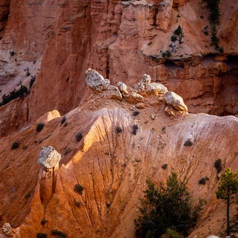
Kanab’s poster-famous Toadstools are impressive in person, especially when dusted in snow.
Photo: Jenny Willden

Photo: Clark Goldsberry

Willis Creek Canyon
Willis Creek Narrows: 4.8 miles or less
On this fine short hike, the only destination is the narrows of Willis Creek. Go as far as you wish; the best narrows are along the first 1.3 miles.
Lick Wash: 8 miles
Exciting narrow passages in the upper reaches of Lick Wash give way to a wider canyon below, embraced by the bold White Cliffs of Navajo Sandstone studded with tall pines, rising 600 to 800 feet to the mesa rims above.
Family Hikes Nearby
Kodachrome Basin State Park — Panorama Trail: 5.4 miles
Punctuated by the white chimneys of sand pipes, and the orange cliffs, spires, and fin-like ridges of Entrada Sandstone that dominate the basin, this is one of the more spectacular areas in southern Utah, a land renowned for its unique landscapes.
Wire Pass to Buckskin Gulch: 3.4 miles
This is an excellent easy hike through Wire Pass into the famous gorge of Buckskin Gulch in the Paria Canyon Wilderness area. You can extend the day hike as far as you wish by exploring Buckskin’s narrows either up- or down-canyon and extremely well-prepared backpackers can take on the whole thing.
The Toadstools: 1.5-mile round-trip
A land of balanced rock formations thatwhich look like mushrooms, The Toadstools is an enchanting wilderness area stroll between Kanab and Lake Powell that's fun for the whole family.
Family-Friendly Trails in Escalante Canyons Region
The Escalante Canyons are the premier hiking destination in the Glen Canyon region. The unique landscape, reliable water in many canyons, and hiking routes that traverse the spectrum of difficulty combine to make the Escalante region an increasingly popular alternative destination to the national parks of Utah.The area's geology can be summed up in one word: slickrock. Particularly in the upper Escalante Canyons, just below Boulder Mountain, the slickrock gorges emerge so suddenly and with such profound dimensions that they are a scene of visual inspiration rivaled in a few places on the Colorado Plateau.
Typical of the canyon country of southern Utah, the Escalante Canyons have few established trails. Most hikes follow the corridors of washes or cross open expanses of slickrock. The exception is the trail to Lower Calf Creek Falls, one of the few constructed and maintained trails in the Glen Canyon region.There are few easy hikes in the Escalante region, but the ones included here are some of the best, providing some of the finest backcountry hiking in southern Utah. Active waterfalls, arches, narrow canyons, riparian oases, and sculpted slickrock are among the attractions of the Escalante’s backcountry.


Lower Calf Creek Falls in Escalante.

Escalante Natural Bridge: 3.2 miles
The upper Escalante River canyon is not only one of the most beautiful parts of the 85-mile-long canyon, but it is also the easiest to reach. Its friendly terrain is unencumbered by dense brush thickets and boulder fields.
Lower Calf Creek Falls: 6.2 miles
A spectacular cliff-bound canyon, a perennial stream featuring beaver ponds and abundant trout, and a memorable veil of whitewater—one of the very few active waterfalls in the southern Utah desert, plunging into a cold, deep pool—combine to make this trip a must-for any hiker visiting the region.
Devils Garden: up to 0.7 miles
The Devil's Garden Outstanding Natural Area is a miniature wonderland of Navajo Sandstone hoodoos, domes, narrow passages, and small arches, hidden from the view of drivers along Hole-in-the-Rock Road.
Forty Mile Ridge to Sunset Arch: 3 miles
Sunset Arch is a delicate, graceful span on the south slopes of Fortymile Ridge. Vistas along the way to the arch are far-ranging, and the walking is easy, with no obstacles, although it is not on an established trail.
Willow Gulch Trailhead to Broken Bow Arch: 4 miles
Willow Gulch offers one of the best short day hikes in the lower Escalante Canyons, also suitable as an overnight trip. Interesting narrow passages, a ribbon of riparian foliage, beaver ponds in the small stream, and the large Broken Bow Arch are major attractions.
Advanced Hikes in Grand Staircase Region
The Grand Staircase area is the most remote and seldom-visited section of the Glen Canyon region. It is spectacular and contains the most extensive network of Utah’s slot canyons. Most of the hikes are off-trail, following dry, easily passable washes through some of the finest narrows in the region. Some of the best longer day hikes and potential backpack trips are included here.


Buckskin Gulch
Yellow Rock/The Box of the Paria River: 6.8 miles
This trip, is only recommended only for experienced hikers with good route-findingroutefinding skills., It offers a memorable blend of slickrock, mesa top, and canyon landscapes, including tremendous far-ranging vistas.
Lick Wash to No Mans Mesa: 12 miles
This rigorous hike follows the dramatic canyon of Lick Wash to the valley of Park Wash, then ascends what remains of the goat trail to No Mans Mesa.
Mollies Nipple: 10 miles
Punctuating the uniform landscape of Grand Staircase, the landmark cone of Mollies Nipple is an anomaly, a mountain-like peak standing alone in a land of mesas, cliffss, and canyons.
Paria Movie Set to Buckskin Gulch: 8.4 miles
This is a demanding day hike for experienced hikers only, as it involves an ascent of the Vermilion Cliffs to Starlight Arch.
Middle Route to Buckskin Gulch: 2.8 miles
The Middle Route offers a short, no-nonsense approach to the lower reaches of Buckskin Gulch, a spectacular slot canyon.
Advanced Hikes in Escalante Canyons Region
The Escalante Canyons are the premier hiking destination in the Glen Canyon region. The unique landscape, reliable water in many canyons, and hiking routes that traverse the spectrum of difficulty combine to make the Escalante region an increasingly popular alternative destination to the national parks of Utah.
The area's geology can be summed up in one word: slickrock. Particularly in the upper Escalante Canyons, just below Boulder Mountain, the slickrock gorges emerge so suddenly and with such profound dimensions that they are a scene of visual inspiration rivaled in few places on the Colorado Plateau. Active waterfalls, arches, narrow canyons, riparian oases, and sculpted slickrock are among the attractions of the Escalante’s backcountry.
Typical of the canyon country of southern Utah, the Escalante Canyons have few established trails. Most hikes follow the corridors of washes or cross open expanses of slickrock.


Boulder Mail Trail to Death Hollow: 10.8 miles
A popular backcountry route that offers one of the finest slickrock rambles on the Colorado Plateau. This fine out-and-back day hike follows part of the Boulder Mail Trail into Death Hollow, the most dramatic of all the upper Escalante Canyons.
Upper Calf Creek Falls: 2 miles
Few hikes in the Escalante region offer the rewards of this fine short trip with such a minimal investment of time and effort. Vast expanses of Navajo Sandstone slickrock, far-ranging vistas, plus an 87-foot-high waterfall, pools of cool water and shady riparian oases await hikers following this well-worn trail.
Escalante River Trailhead to Maverick Bridge and Phipps Arch: 6.6 miles
This rewarding day hike combines a walk along the Escalante River, including at least one ford, with an ascent of dry Phipps Wash and a visit to two distinctive natural spans, Phipps Arch and Maverick Bridge.
Fiftymile Creek: 10.4 miles
Fiftymile Creek is a remote slickrock canyon of exceptional beauty. Seldom visited, the canyon offers solitude and classic scenery. Narrow passages, 500-foot canyon walls, excellent campsites, a perennial stream and an active population of beaver are among the attractions of this trip.
The Box: 8 miles
This canyon provides a backcountry landscape like no other in the Escalante region. Its slickrock canyon and cliffs, mountain forest, and clear, cold creek make it suitable as a backpacking destination.