Winter in Southern Utah can mean more solitude along the trails.

Zebra Canyon, Hole-in-the-rock road

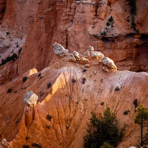
Toadstools in Grand Staircase Escalante
Travel Tips
When to Visit: Weather, Seasons, Elevation
Grand Staircase-Escalante National Monument is a high-elevation desert, ranging from 8,600 to 8,640 feet. The monument is open year-round. However, some businesses surrounding the park—in Kanab, Boulder and Escalante—close for the winter.
- December, January, February: average high of 48°F; average low of 17°F
- March, April, May: average high between 57°F to 75°F; average low of 40°F
- Jun, July, August, September: average high between 80°F and 92°F: average low of 50°F
- October, November: average high between 54°F - 68°F; average low of 30°F
Driving to Trailheads: 2WD vs 4WD
Nearly all the trailheads in the monument are usually accessible to 2WD cars in dry weather. However, a four-wheel-drive (4WD) vehicle is recommended when traveling off the pavement in southern Utah. Keep in mind that flash floods can deposit rocks and debris onto roads, so actual driving conditions can change quickly. Nearly all the trailhead access roads pass over clay beds, and during and shortly after rainfall these roads become slippery, sticky avenues of mud. Avoid driving these unpaved roads when they are wet. The clay can become impassable when wet, even to 4WD vehicles. If you find yourself on a wet dirt road, be prepared to wait a day or two for the roadbed to dry out.
Plan For Flash Floods On Unpaved Roads
Most trailhead access roads are graded only twice a year: once in spring and again in autumn. Expect road damage following significant rainfall, and particularly following an active summer monsoon season. Flash floods and runoff from heavy rain will make desert roads impassable to all but high-clearance 4WD vehicles. Always inquire about road conditions with the local BLM office and visitor centers prior to driving any unpaved road.
What To Pack For Driving Unpaved Roads
Unexpected storms, washouts, mud, rocks, and sand can stop you or strand you in the desert. Drivers have been stranded in their cars for days at a time on remote roads after only one afternoon of heavy rain. Travelers must come prepared to wait out inclement weather and impassable road conditions.
- Full tank of gas
- Tow rope of chain
- Tool kit
- Jumper cables
- Roll of duct tape
- Tire Pump
- Ample water and food to sustain your group for two to four days
- Plenty of matches and fuel for stove
- Shovel — a little road work with a shovel can save you hours of digging out should you become stuck or high-centered
Can You Drive Through Grand Staircase-Escalante?
Yes, you can drive through the monument — if you’re up for the challenge. The 55-mile Hole in the Rock Road, starting near the town of Escalante and ending at Lake Powell, requires 4WD and much preparation.Nearby Basecamp Towns
-

Boulder
Boulder, Utah, is a remote, charming town full of scenic beauty. This gateway to Grand Staircase-Escalante National Monument and Capitol Reef National Park offers relaxation and outdoor adventure.
-
Escalante
Between Capitol Reef and Bryce Canyon national parks and perched on the edge of Grand Staircase–Escalante National Monument, the town of Escalante offers access to some of the most beautiful parts of Southern Utah.
-
Kanab
Kanab, Utah is classic American West, surrounded by towering Navajo sandstone cliffs and vistas of sagebrush. Kanab's self-proclaimed title, "Little Hollywood," is fitting for its many abandoned film sets.


Big Water Visitor Center
Photo: McGhiever/Wikimedia Commons
Grand Staircase-Escalante Visitor Centers
North Entrance: Escalante Interagency Visitor Center
This visitor center in the town of Escalante is packed with information about the local geology and ecosystem of nearly one million acres that encompass the Monument.
Find up-to-date information on road conditions and hiking trails. Opened to the public in 2005, the center is one of the Department of Interior's first Gold LEED-rated facilities. It is staffed with personnel from the Bureau of Land Management, National Park Service and Forest Service.
South Entrance: Big Water Visitor Center
The Big Water Visitor Center and dinosaur museum is a great stop on your way to visit Lake Powell, Antelope Canyon, and Glen Canyon Dam, or to hike one of the numerous trails located within the Grand Staircase region. The center has knowledgeable staff, a lot of great dinosaur fossil displays, and a 30-foot mural depicting the Cretaceous Period. It’s located between the city of Page, Arizona, and Kanab, Utah, along Highway 89 and sits on the southern border of the monument.