Cycling the Alpine Loop
A local’s favorite for fall splendor, the Alpine Scenic Loop offers a narrow, windy road with lush vegetation and outstanding vistas.
The Route
This route as described below will be just under 40 miles, with a total elevation gain of 4,200 vertical feet. If you are comfortable with a little more mileage and wish to avoid the gravel of the Deer Creek Trail, replace it at the beginning of the ride by taking Stringtown Road, turning left on Tate Lane, and then right on Route 113 until it connects with Highway 189. You will then ride clockwise around Deer Creek State Park's reservoir until you come to the dam at the south end; the rest of the ride is the same. Or you could do any variation of out-and-back incorporating the Alpine Loop and Cascade Springs connector (but then it wouldn’t be a loop, right?).
From the center of Midway, head south on 250 West, then west on 500 South, then due south on Stringtown Road. You’ll pass the intersection of Tate Lane on the left, which comes in from Route 113, and you will pass the historic Tate Barn. Look for a small parking area on the left that will cross the rail tracks of the infamous Heber Creeper, which will give you access to the Deer Creek Trailhead. (Google Maps will show this gravel path marked as the Provo-Jordan River Parkway, but the signage indicates Deer Creek Trail.) This path follows the hillside above Deer Creek Reservoir and the rail line. It will make a few switchback turns here and there and climb a few steep hills making it challenging, but not impossible, on a normal road bike. It’s about a 7-mile trail that ends at the dam at the south end. Here you jump out on the pavement and relatively wide shoulder of Highway 189, locally known as Provo Canyon, east of Provo, Utah.
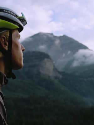
About two miles down the canyon, you’ll take the right-hand turn clearly marked for Sundance Resort. Now the real climbing begins. From the turn to the Cascade Springs turn-off at the top, you are looking at about 8.5 miles and 2,700 vertical feet of climbing with average gradients of 6 percent. The closer you get to the turnoff, the denser the aspens of the Uinta-Wasatch-Cache National Forest become. Soaking up views of the high glacier-carved peaks and basins of Timpanogos, you’ll wish this road went on forever, despite the fact that you are climbing.
Take the turn to Cascade Springs, which will reward you with a screaming descent and amazing views of high alpine peaks and the Heber Valley far below. There are a few minor climbs before the final descent down to the Cascade Springs parking area. You’ll take Old State Road 220 to climb out of Cascade Springs, and there is a nasty little pitch on broken pavement that will take you to the top where it then turns to gravel, and you will descend back down to Midway, eventually turning into Cascade Springs Drive and coming back out on Stringtown Road. It’s about five miles of descent on loose gravel with a few switchbacks, and it’s doable on road tires if you don’t mind your hands turning white from squeezing the brakes all the way down.
